
Leica Geosystems
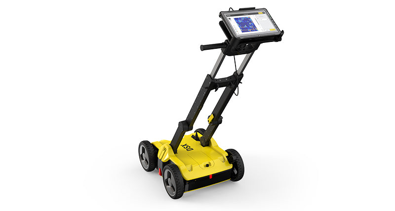
Leica DSX Utility Detection Solution
Price
€0.00


Detection & InspectionGround Penetrating RadarHomepage FeaturedLeica Geosystems Leica DSX Utility Detection Solution
Call for price
01 627 0975Leica DSX Utility Detection Solution
Spec Videos Brochure- Ensure smooth and accurate underground utility detection without expert knowledge
- Complete utility detection and mapping in just a few steps through intuitive user interface
- Scan anywhere and at any time, even in narrow areas and under severe conditions
- Save your time on site by mapping underground utilities in just minutes
- Export utilities in CAD or BIM-read formats for further usage
- Create professional reports, customised to your and your customers' needs
- Detect all types of underground utilities in high resolution to assure reliable avoidance zones
- Verify detected utilities with support of smart algorithm
- Import of POI's and utility records to help you make better decisions
- Offer a complete workflow from acquire to excavate
- Locate underground utilities with survey-grade accuracy
- Generate utility maps, compatible with all coordinate reference systems
Reliable utility detection for everyone simple detection workflow and results that anyone can understand
The Leica DSX utility detection solution, consisting of a portable hardware with intuitive software allows to easily locate, visualise and map utilities. Unlike any other ground penetrating radar (GPR) system, the Leica DSX maximises productivity with cutting-edge software that automates data analysis and creates a 3D utility map on the field.
Ease of Use
Instant 2D/3D Utility Map
Reliable Detection Results
Integrated Solution
|
|
|
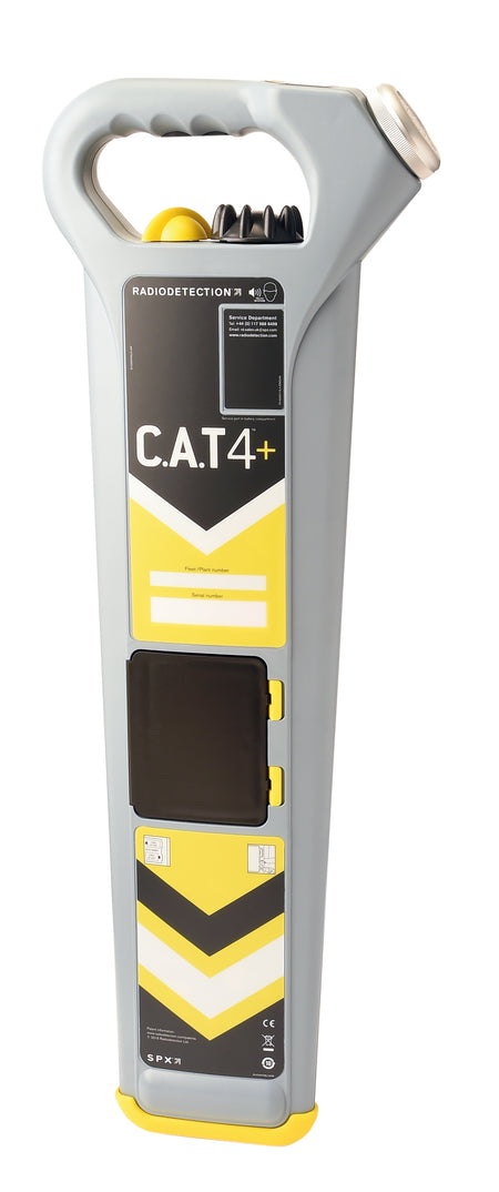
1:Collect information Start by collecting utility records from utility company or local council. Upload them into DXplore. Use an C.A.Tto search for power cables and conductive utilities and mark them on the ground. |
2:Map utilities with Leica DSX Set up agrid in the area of interest and collect information about all underground utilities with the DSX and take advantage of automated and supported post-processing on site, resulting in a 3D map.Use the DSX with Leica GPS/GNSS systems to generate highly accurate, georeferenced maps. |
3: Excavate safely Mark out utilities in the field based on the map or, for even more efficiency, send the utility map directly to an excavator with Leica MC1 software or other Leica software suites. |
You May Also Like
€490.00
(€602.70 inc. VAT)
€895.00
(€1,100.85 inc. VAT)
€99.00
(€121.77 inc. VAT)
€790.00
(€971.70 inc. VAT)

€555.00
(€682.65 inc. VAT)
Call for price
