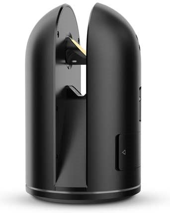
Leica BLK360 G1
Homepage FeaturedLeica BLK RangeLeica GeosystemsReality Capture Leica BLK360 G1
Call for price
01 627 0975The Leica BLK360 Generation 1
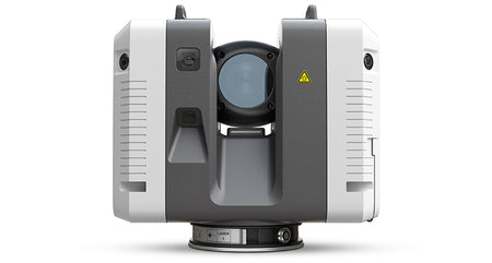
The Leica BLK360 captures the world around you with full-color panoramic images overlaid on a high-accuracy point cloud. Simple to use with just the single push of one button, the BLK360 is the smallest and lightest of its kind. Anyone who can operate an iPad can now capture the world around them with high-resolution 3D panoramic images.
Using the ReCap Pro mobile app, the BLK360 streams image, and point cloud data to iPad. The app filters and registers scan data in real-time. After capture, ReCap Pro enables point cloud data transfer to a number of CAD, BIM, VR, and AR applications. The integration of BLK360 and Autodesk software dramatically streamlines the reality capture process thereby opening this technology to non-surveying individuals.
BLK360 Imaging Laser Scanner
- Allows you to scan in high, standard, and fast resolutions
- Weighs 1kg / Size 165 mm tall x 100 mm diameter
- Less than 3 minutes for a full-dome scan (in standard resolution) and 150 MP spherical image generation
- 360,000 laser scan pts/sec
ReCap Pro Software
- Gain complete access to ReCap Pro for desktop, web and mobile*
- Control all aspects of the reality capture process remotely on ReCap for iPad
- Automatically register and visualise scan data in the field
- Mark up, tag and collaborate on scans while on the job site
- Reduce rework requests and share reality data remotely
- Seamless data transfer into Autodesk design software
With the combination of the BLK360 and Autodesk ReCap Pro, benefit from:
Speed
On-the-fly image and point cloud processing in the field.
Portability
Flexibility to scan wherever, whenever with the small lightweight scanner that fits into a messenger bag.
Ease of Use
Push-button scanning that automatically stitches and registers in the mobile version of ReCap Pro.
Cloud Connectivity
Better collaboration and virtualisation with cloud sync.
Simplified Data Collection
Two-in-one 360¨ image documentation and laser scan data.
Interoperability
Reality capture data connectivity with Autodesk design solutions.
‚ 360,000points/sec
3D POINTACCURACY
‚ 6mm @ 10m / 7mm @ 20m
RELATIVE ACCURACY
+/- 0.1% (typically)0.625 horizontal, 1.8 vertical
MAXIMUM RANGE
‚min 0.6 up to 60m
